Museum Quality Print
Available in multiple sizes & formats
Share this artwork:
Artwork Details
Year
c. 1650
Era
Baroque
Collection
Wikimedia Commons
Medium
Hand-colored engraving
Explore by Subject
About This Artwork
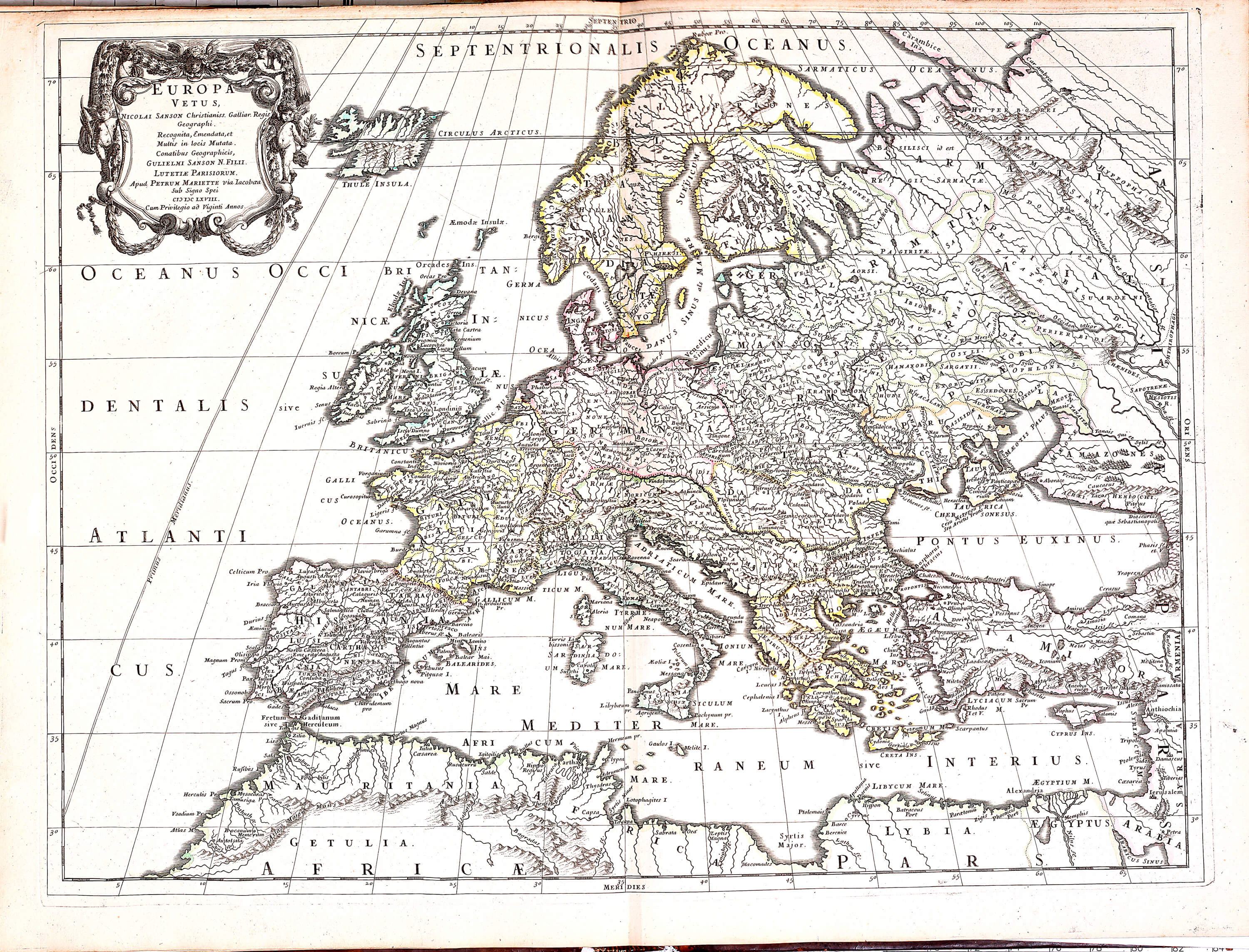
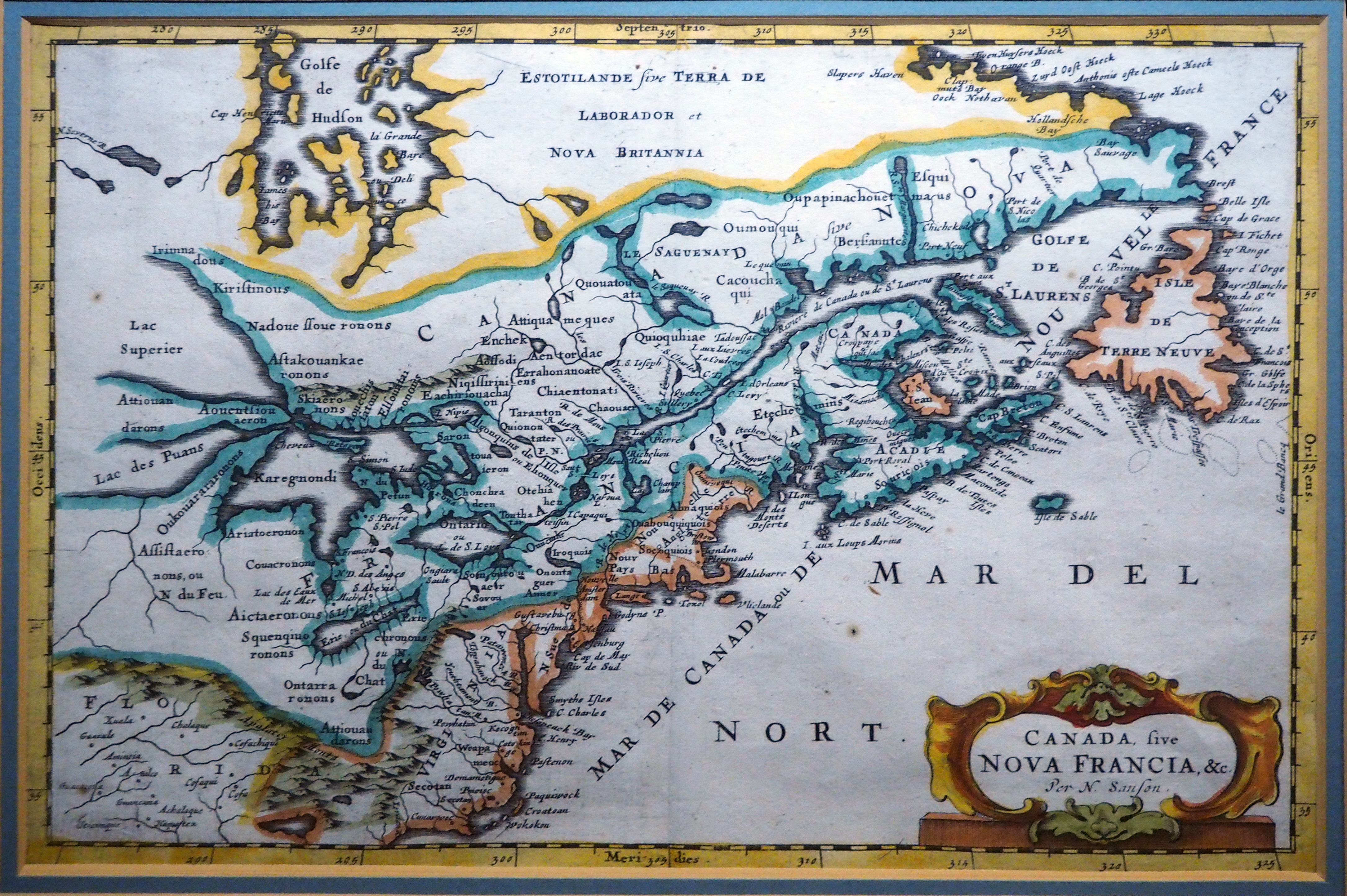
Sanson's comprehensive map of Europe, showcasing the founder of French cartography's scientific approach. The map depicts the entire European continent with political boundaries, major cities, rivers, and mountain ranges. A decorative title cartouche features classical architectural elements and allegorical figures. The map shows Europe during the Thirty Years' War period, with complex political divisions clearly marked. Coastal details are particularly accurate, reflecting improved maritime surveys. The map established new standards for European cartography with its emphasis on accuracy over decoration. Copper engraving with period hand-coloring highlights national boundaries and geographical features.
Loading print options...
More by Nicolas Sanson
Explore more works from this artist
More from Antique Maps
Explore related artworks in the Antique Maps collection