Museum Quality Print
Available in multiple sizes & formats
Share this artwork:
Artwork Details
Year
1606
Era
Baroque
Collection
Wikimedia Commons
Medium
Hand-colored engraving
Explore by Subject
About This Artwork
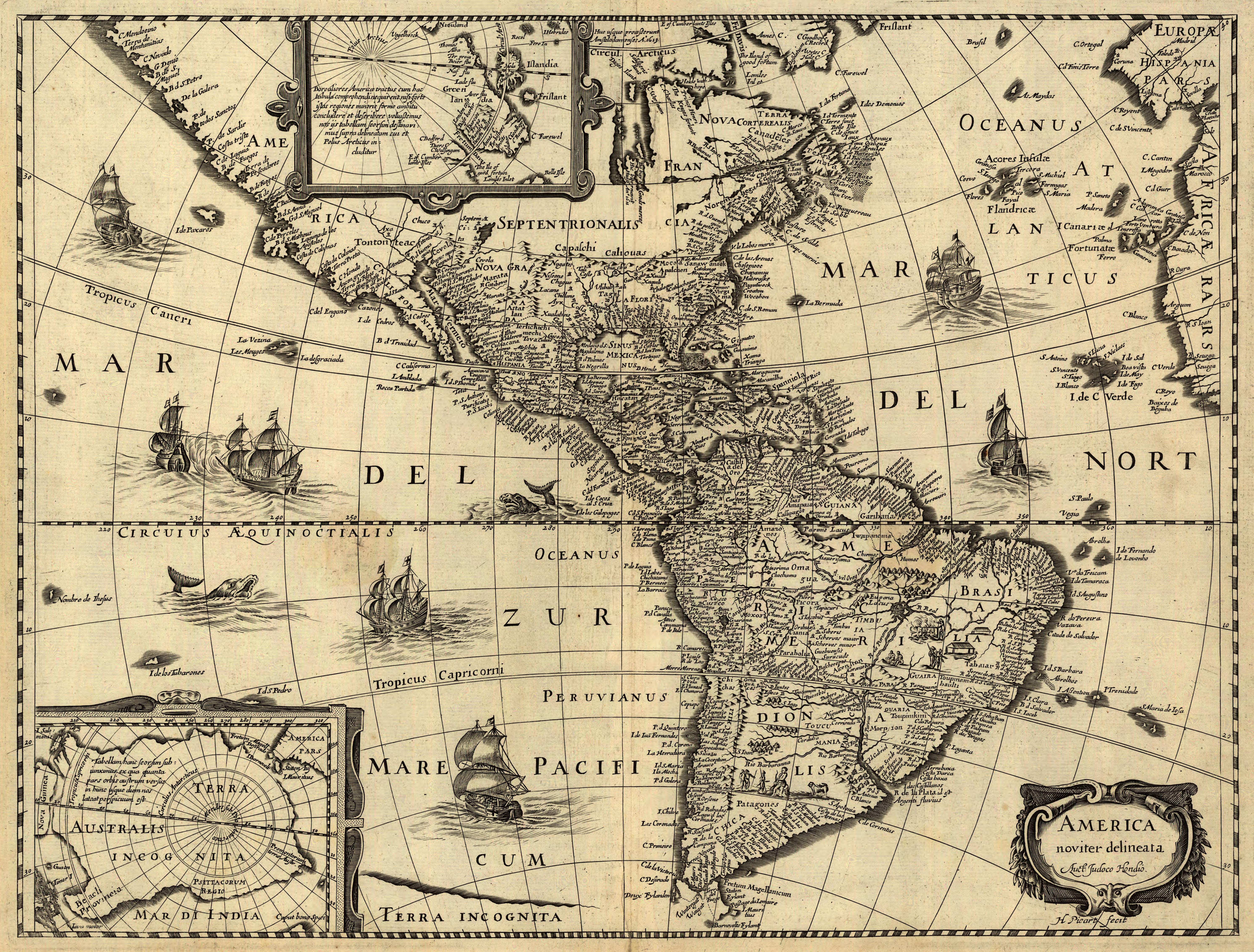
A beautifully engraved map of the Americas featuring elaborate decorative elements typical of Dutch Golden Age cartography. The map includes ornate cartouches with indigenous figures, European ships sailing the Atlantic, and sea monsters in unexplored waters. California is shown as a peninsula, and the Great Lakes region remains largely unmapped. The decorative borders feature vignettes of Native American life and European colonial settlements. Hand-colored in period style with vibrant blues for oceans and greens for landmasses. The map reflects early 17th-century understanding of New World geography, with significant blank areas in the interior representing terra incognita.
Loading print options...
More by Jodocus Hondius
Explore more works from this artist
More from Antique Maps
Explore related artworks in the Antique Maps collection