Museum Quality Print
Available in multiple sizes & formats
Share this artwork:
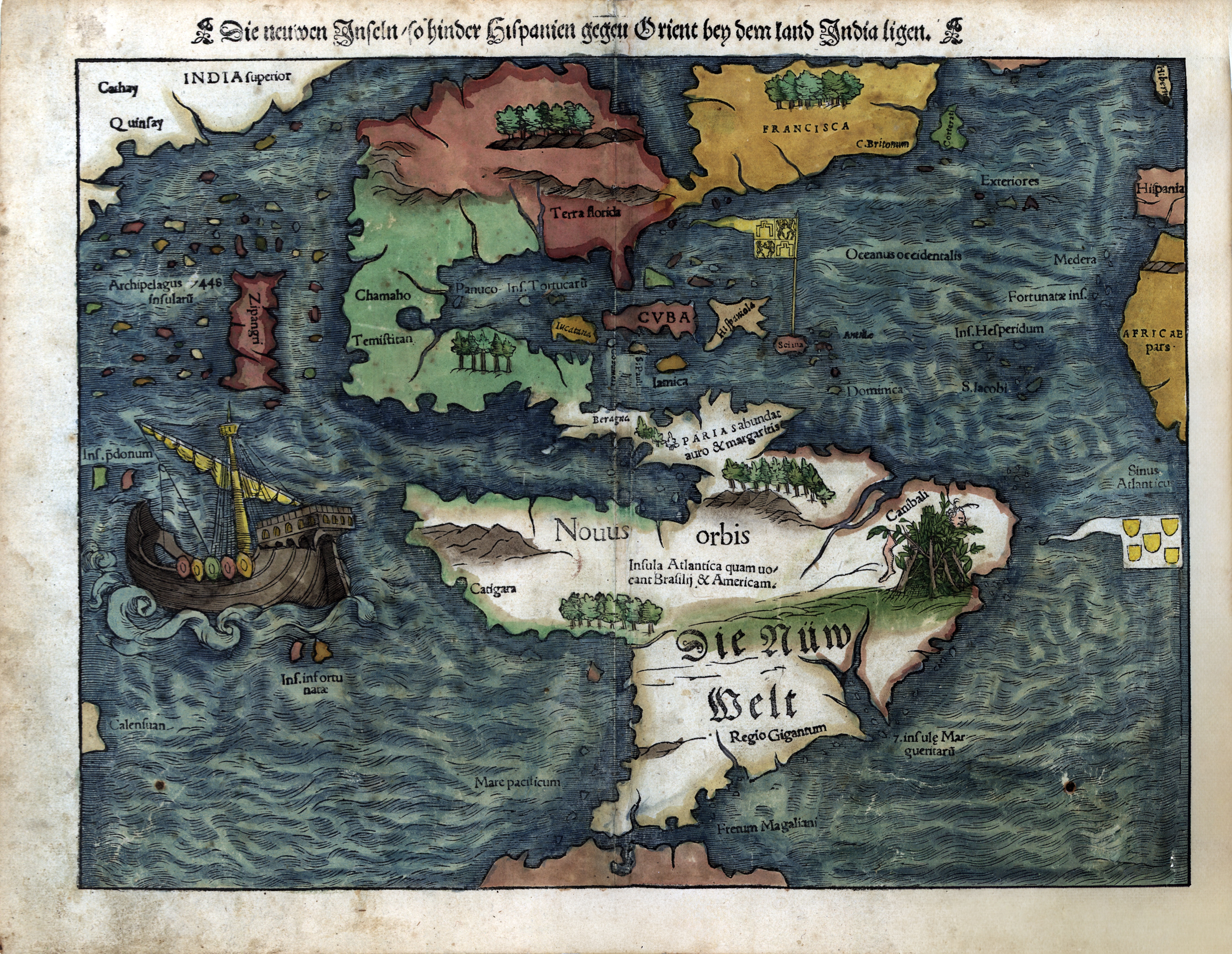
Die newen Jnseln (The New Islands near India)
Artwork Details
Year
c. 1540-1560
Era
Renaissance
Collection
Private Collection
Medium
Hand-colored engraving
Explore by Subject
About This Artwork
A stunning hand-colored 16th-century German map depicting the 'new islands behind Spain toward the Orient near the land India.' The map shows early European understanding of the Caribbean (Cuba, Hispaniola) and the American continents labeled as 'Novus orbis' (New World). Features magnificent decorative elements including a detailed sailing ship with golden sails, sea monsters, and elaborate cartographic styling typical of early modern German cartography. The map represents the Age of Discovery when European knowledge of the Western Hemisphere was still being formed and refined.
Loading print options...
More from Antique Maps
Explore related artworks in the Antique Maps collection