Museum Quality Print
Available in multiple sizes & formats

Share this artwork:
About This Artwork
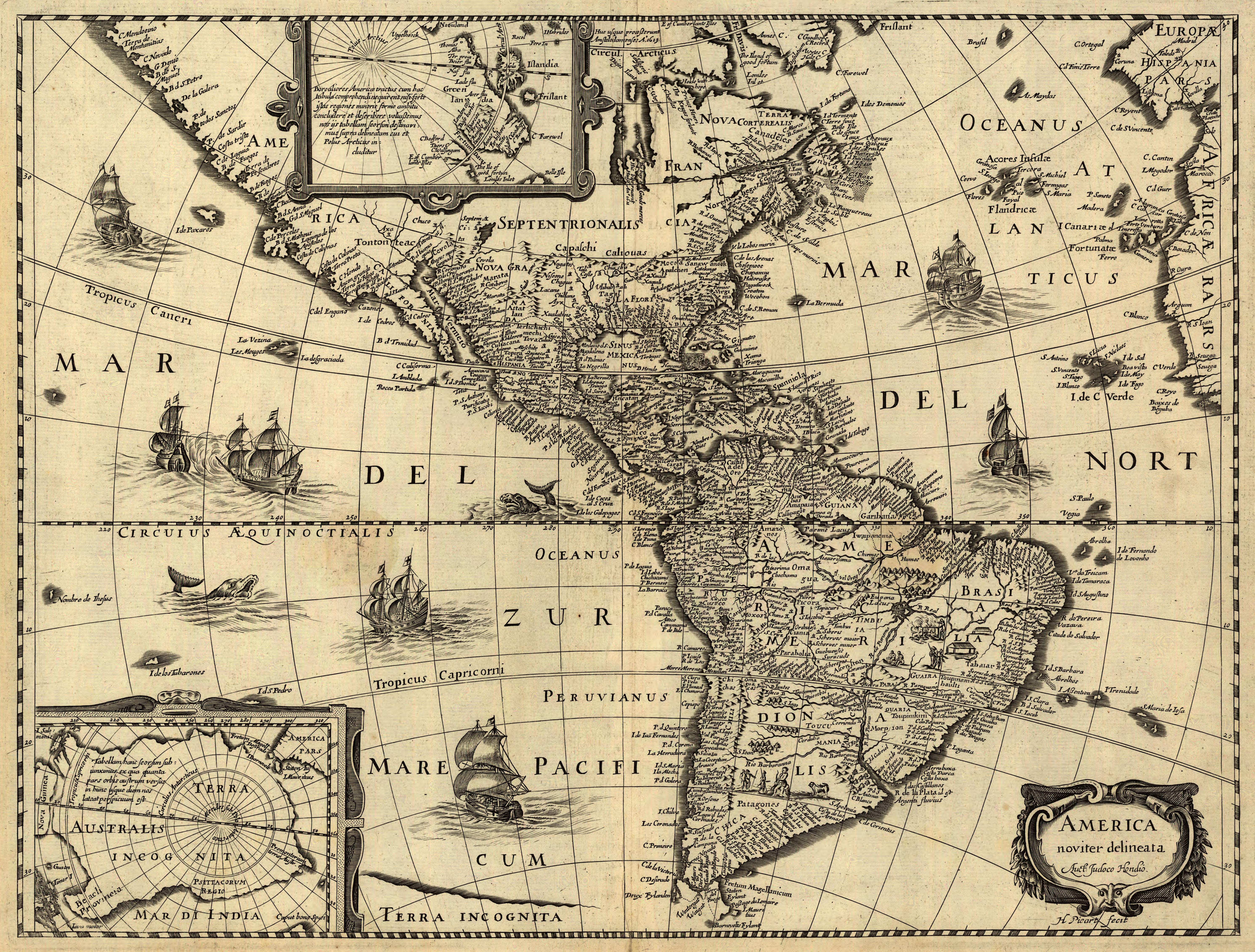
Highly detailed Mercator projection world map attributed to Edward Wright, featuring comprehensive navigation lines, coastal details, and English annotations. Museum-quality resolution suitable for large format prints. **Geographic Region:** World **Source:** Gallica (BnF) **Resolution:** 11124x8238 pixels **Status:** Pending QC Review - Not Published
Loading print options...
More from Antique Maps
Explore related artworks in the Antique Maps collection