Museum Quality Print
Available in multiple sizes & formats
Share this artwork:
Artwork Details
Year
c. 1730
Era
Enlightenment
Collection
Wikimedia Commons
Medium
Hand-colored engraving
Explore by Subject
About This Artwork
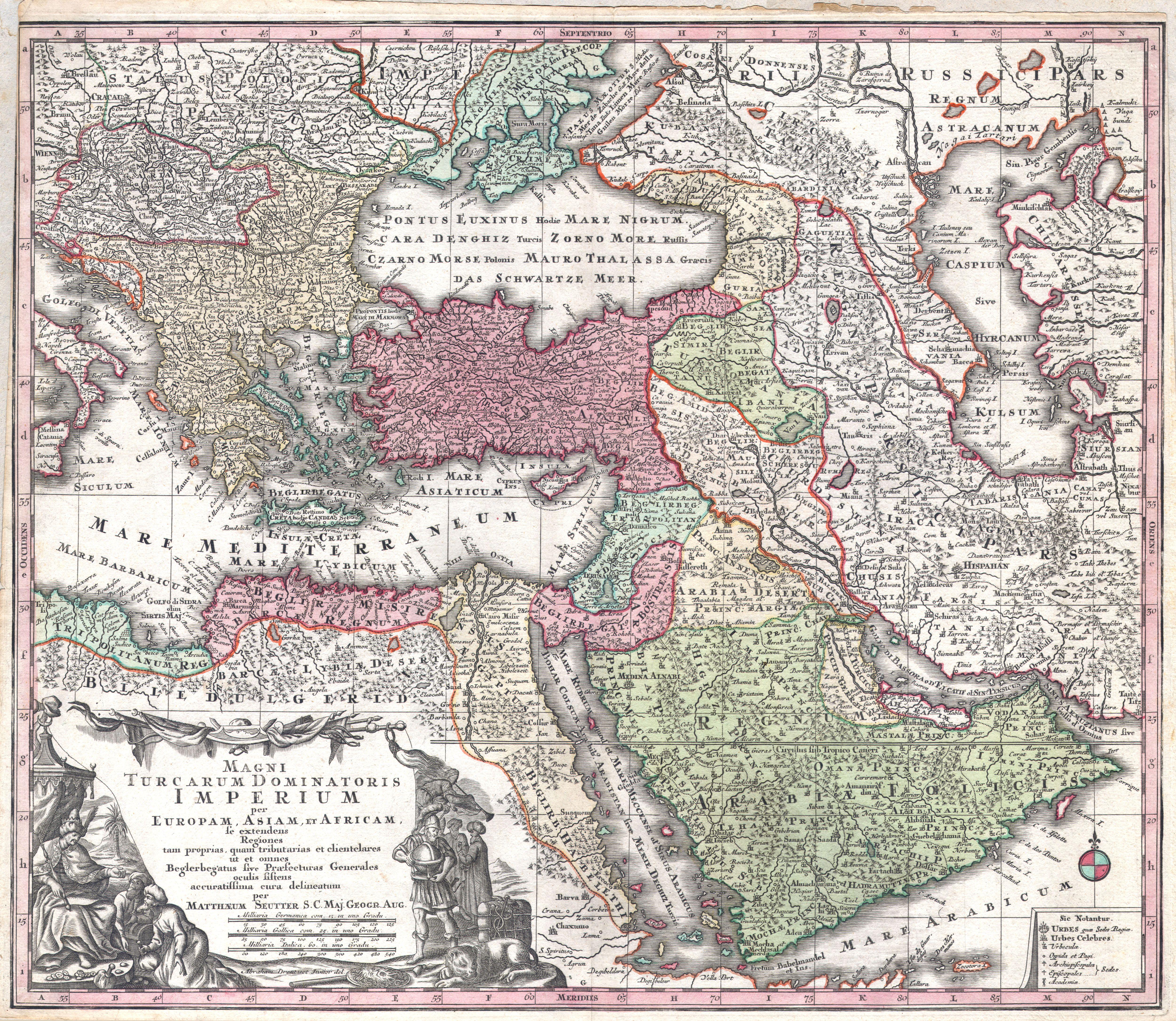
Seutter's elaborate map of the Ottoman Empire, Persia, and Arabia, showing the vast Islamic territories in the early 18th century. The map features magnificent baroque cartouches with Turkish figures, military scenes, and architectural elements. Major cities including Constantinople, Cairo, Baghdad, Damascus, and Mecca are prominently marked. The map shows the complex administrative divisions of the Ottoman Empire and Persian territories. Decorative elements include Ottoman military encampments, sailing ships in the Mediterranean and Red Sea, and ornamental compass roses. The map reflects European fascination with and fear of Ottoman power. Exquisite copper engraving with rich hand-coloring highlights the empire's vast extent.
Loading print options...
More from Antique Maps
Explore related artworks in the Antique Maps collection