Museum Quality Print
Available in multiple sizes & formats
Share this artwork:
Artwork Details
Year
c. 1627
Era
Baroque
Collection
Wikimedia Commons
Medium
Hand-colored engraving
Explore by Subject
About This Artwork
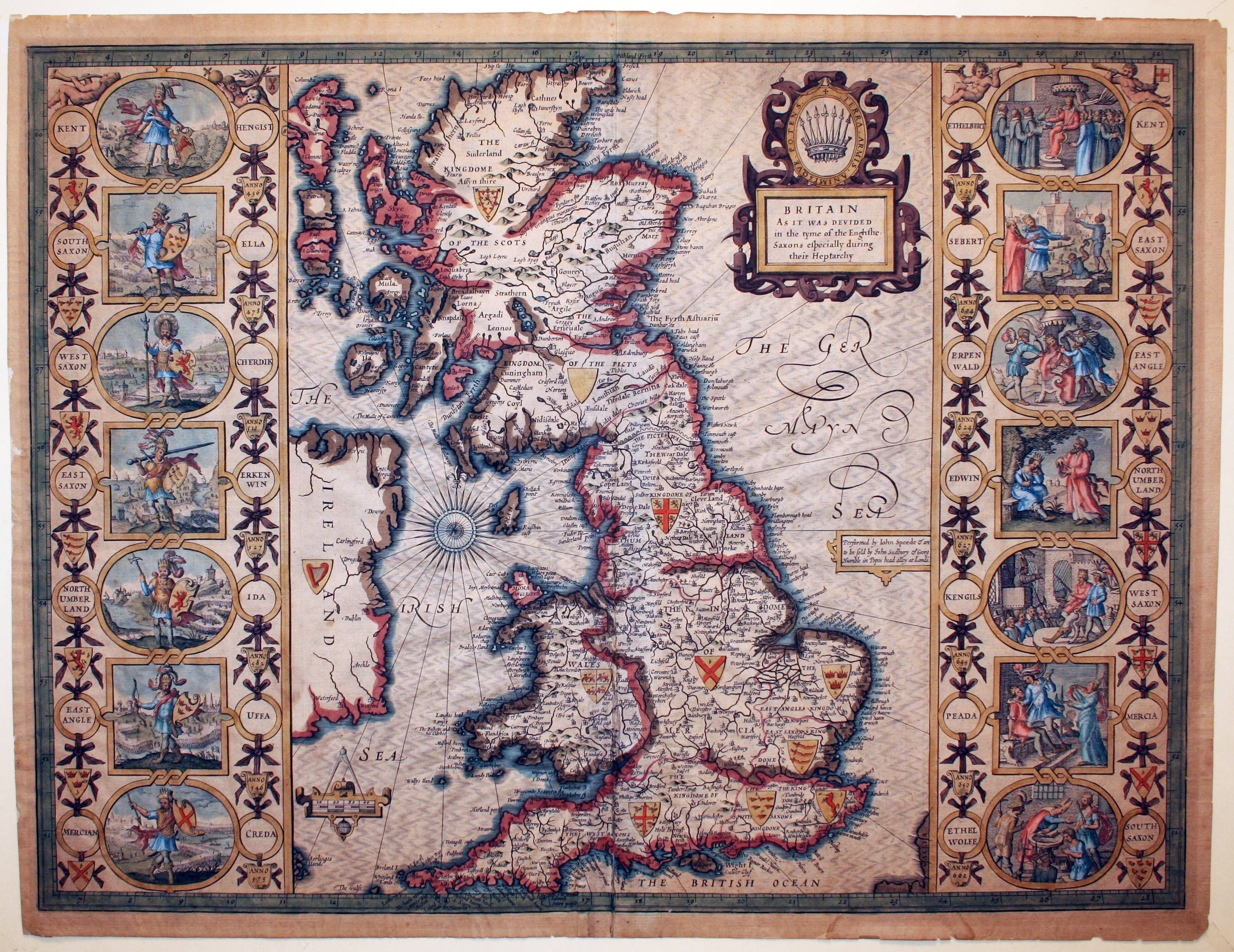
Speed's historical map showing the seven Anglo-Saxon kingdoms of England (the Heptarchy) during the early medieval period. The map depicts Northumbria, Mercia, East Anglia, Essex, Kent, Sussex, and Wessex with their approximate boundaries. Decorative elements include portraits of Saxon kings, heraldic shields, and ornamental cartouches. The map combines historical scholarship with artistic presentation, showing how England was divided before unification. Text panels provide historical context about each kingdom. This map demonstrates Speed's interest in English history and his skill in presenting complex historical geography in an accessible format.
Loading print options...
More by John Speed
Explore more works from this artist
More from Antique Maps
Explore related artworks in the Antique Maps collection