Museum Quality Print
Available in multiple sizes & formats
Share this artwork:
Artwork Details
Year
1606
Era
Baroque
Collection
Wikimedia Commons
Medium
Hand-colored engraving
Explore by Subject
About This Artwork
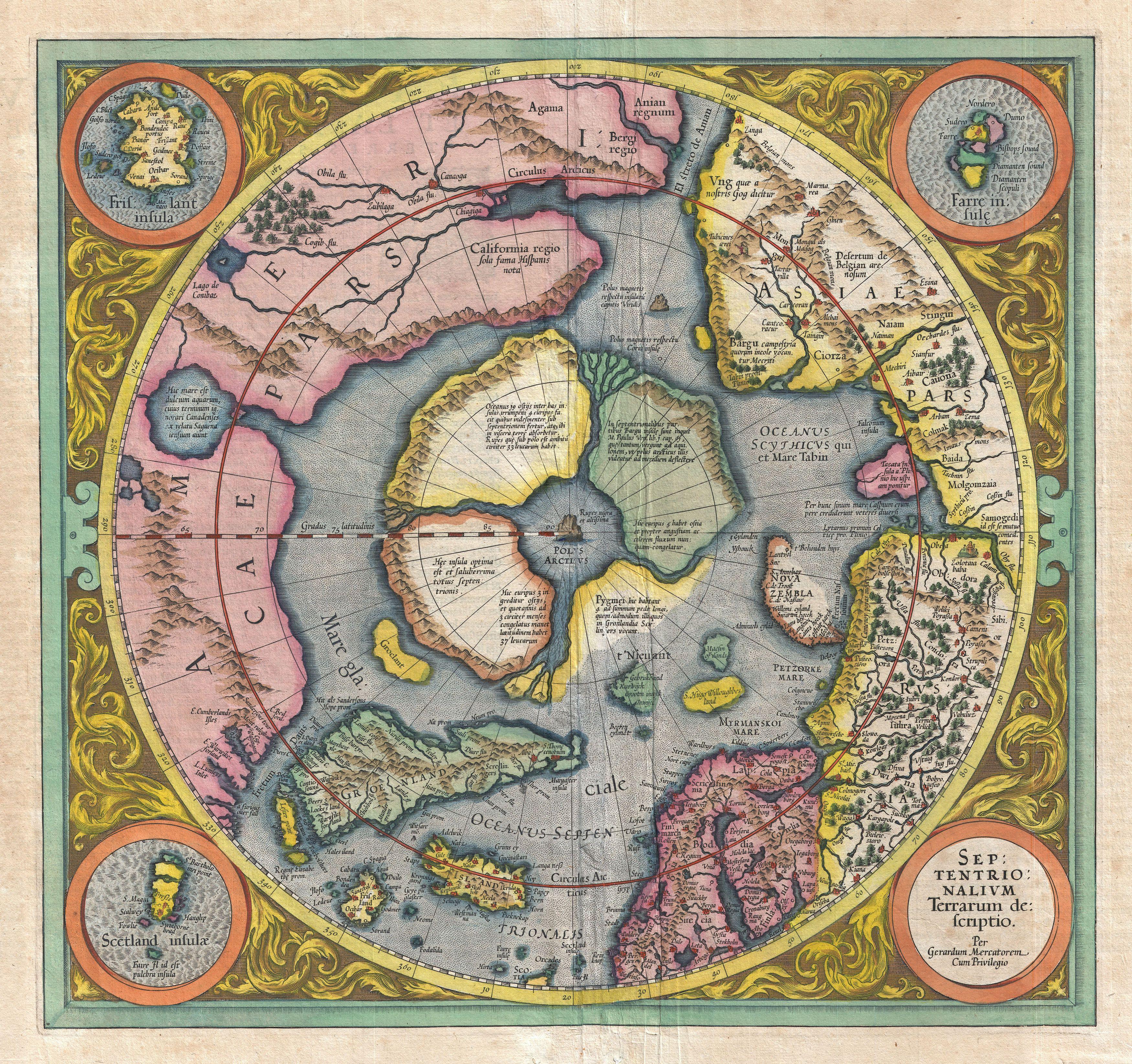
The first printed map specifically depicting the North Pole and Arctic regions, based on Mercator's polar projection. This remarkable map shows the Arctic Ocean surrounded by the northern coasts of Europe, Asia, and America. A massive whirlpool is depicted at the North Pole, based on medieval legends. The map includes decorative cartouches with polar bears, whales, and Arctic explorers. Sailing ships navigate the icy waters, and sea monsters lurk in unexplored regions. The map reflects 16th-century theories about polar geography and the search for the Northwest Passage. Ornamental borders and Latin inscriptions add to its scholarly appearance.
Loading print options...
More from Antique Maps
Explore related artworks in the Antique Maps collection