Museum Quality Print
Available in multiple sizes & formats
Share this artwork:
Artwork Details
Year
c. 1657
Era
Baroque
Collection
Sanderus Antique Maps
Medium
Hand-colored engraving
Explore by Subject
About This Artwork
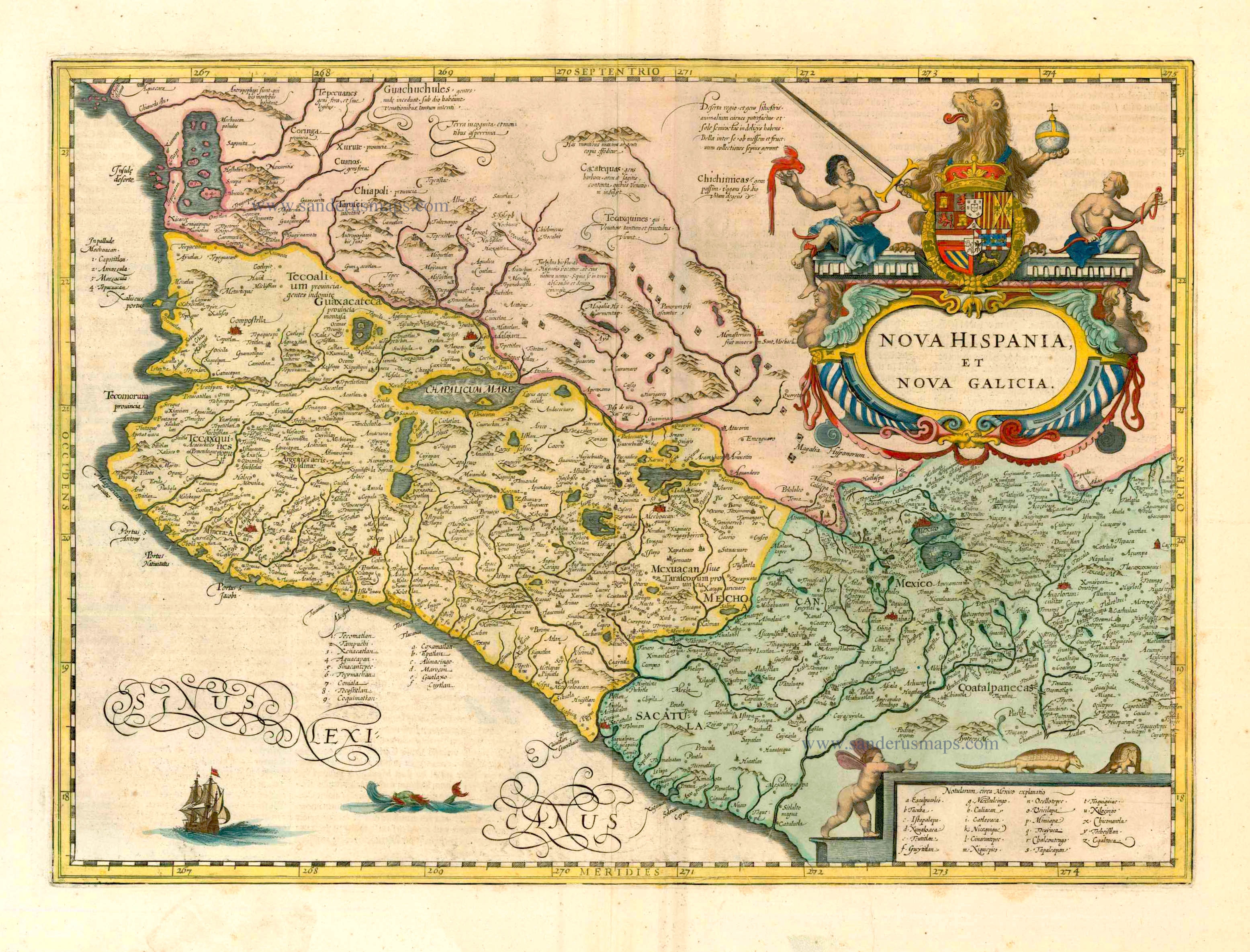
A detailed map of New Spain (Mexico) from Jansson's renowned atlas, showing the extent of Spanish colonial territory. The map features an elaborate cartouche with indigenous and Spanish figures, depicting the cultural encounter between Old and New Worlds. Topographical features include mountain ranges shown in profile, rivers, and coastal details. The Pacific coast is labeled 'Mar del Zur' (South Sea), and the Gulf of Mexico shows numerous sailing vessels. Decorative elements include a scale cartouche with dividers and navigational instruments. The interior shows Spanish missions, mining towns, and indigenous settlements. Rich hand-coloring highlights political boundaries and geographical features.
Loading print options...
More by Jan Jansson
Explore more works from this artist
More from Antique Maps
Explore related artworks in the Antique Maps collection